Brisbane’s heritage buildings, mapped in 3D — and how to find them
Brisbane wears its history unevenly. A workers’ cottage in Paddington, a bank turned bar in the Valley, a windmill on a hill that predates almost everything around it — they sit in the same streets as glass towers, easy to walk past without a second look. We drew all 126,000-odd buildings in the city as an isometric map, and while we were at it we gave one group of them a look of their own: the 558 places on the Queensland Heritage Register. Here’s what that means, how to spot them, and how to browse the lot.
What “heritage-listed” means
A place on the Queensland Heritage Register is one the state has formally recognised as significant — for its architecture, its history, or its part in the story of the place. Listing isn’t a museum label; it’s a legal status that shapes what can be done to a building, which is why so much of old Brisbane is still standing at all. The register covers far more than grand public buildings: timber churches, corner shops, bridges, cemeteries, a fig tree or two, and rows of ordinary houses that together tell you how a suburb grew.
How they look on the map
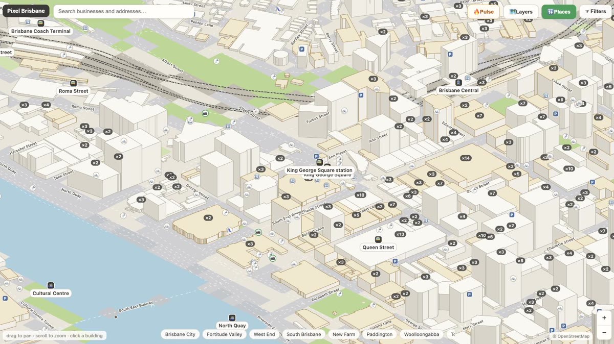
Because the map draws every building in 3D from its real footprint, we didn’t need a pin to mark the listed ones — we could change the building itself. Heritage-listed buildings wear a parchment-coloured roof with a bronze outline, so they stand out from the grey of everything around them without a cluster of markers cluttering the view. Pan across Spring Hill or the CBD and the listed places light up as a scatter of warm rooftops; click any one and you go straight to its register entry, with the suburb it sits in and its spot on the map.
It’s a quiet way to read the city. You start to notice that a whole street is listed, or that the old building you like is one of only a handful left of its kind — things a flat list of addresses never quite tells you.
Browsing all 558
The heritage index is the fast way in. Search any of the 558 places by name, or filter to a suburb — Brisbane City alone holds well over a hundred, with Spring Hill, Fortitude Valley, South Brisbane and Kangaroo Point close behind. Every entry links to its own page, and from there to its exact building on the map. Each suburb page also flags the heritage places nearby, so if you’re reading up on where you live, they’re already there.
A few to start with
We've also started drawing the best-known landmarks as their own pixel-art illustrations — a stylised impression of each building (clearly labelled as an illustration, never passed off as a photo), sitting on its heritage page above the map. City Hall, Customs House, the Treasury and a handful more are done, with the rest to follow. Here are a few worth opening first:
- Brisbane City Hall — the sandstone civic heart, its clock tower once the tallest thing in town.
- The Treasury Building — grand Italianate government offices, now a very different kind of house.
- The Windmill Tower — the oldest surviving building in Brisbane, from the convict years, up on Wickham Terrace.
- Customs House — the copper-domed riverfront landmark by the Story Bridge end of the CBD.
- The Story Bridge — the steel cantilever you can now climb, listed in its own right.
Where the data comes from
The listings come from the Queensland Government’s open data — the Queensland Heritage Register boundaries, published under CC BY 4.0 — matched against OpenStreetMap building footprints so each listing lands on the right roof. Where a register place is a park, a shipwreck, a memorial or anything without a mapped building, we still list it by name; it just doesn’t get a highlighted roof. It’s the same open-data approach behind the rest of the map: public records, cross-checked, drawn where they actually are.
Spot something mislabelled or a listed building that isn’t glowing? There’s a report link on every building card — that’s how the map keeps getting more accurate.